Online or onsite, instructor-led live Pix4D training courses demonstrate through interactive hands-on practice how to analyze image data and create 3D models with Pix4D.
Pix4D training is available as "online live training" or "onsite live training". Online live training (aka "remote live training") is carried out by way of an interactive, remote desktop. Onsite live Pix4D training can be carried out locally on customer premises in Salvador or in NobleProg corporate training centers in Salvador.
NobleProg -- Your Local Training Provider
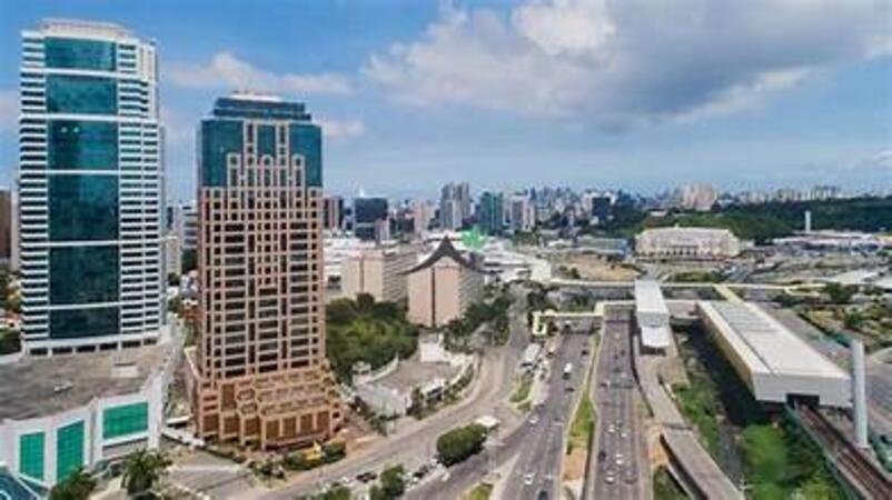
Salvador-Suarez Trade
Av. Tancredo Neves, 450 - Caminho das Árvores, Salvador, Brazil, 41819-900
The Salvador Suarez Trade Center office space is situated on the 16th floor of a 34-story granite blue glass skyscraper, located on a main road through the financial district. Salvador is the second most popular tourist destination in Brazil. National and international real estate developers are investing in the expansion of the city, and construction is one of the most important commercial activities. The city is also attracting major global companies, creating oil plants, car factories and chemicals near Salvador. The port plays a key role in local trade, especially for the transport of agricultural products from the surrounding region. The city is popular for conferences. Salvador Suarez Trade Center has a fully equipped auditorium, a lan house and its own parking lot, and is near one of the city's main shopping centers. You can easily reach the international airport and other transport links.
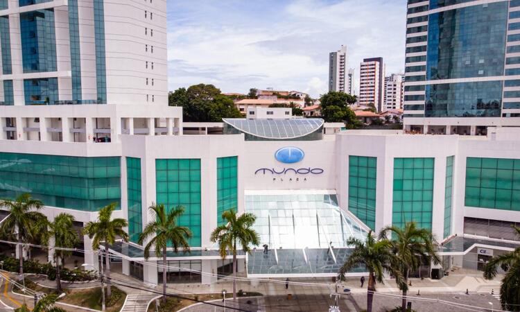
Salvador - Mundo Plaza Centre
Avenue Tancredo Neves, 620 , Salvador , Brazil, 41820-901
Discover the ideal headquarters in this city, known for its business opportunities and as a sought-after tourist spot. Nestled in one of the most vibrant neighborhoods, the recently constructed Mundo Plaza Centre seamlessly blends modern architecture with lush greenery, providing you with an appealing work setting.
Be inspired by the stunning vistas from this airy and expansive office space. And after a productive day, immerse yourself in the finest accommodations, boutiques, and cultural offerings that Salvador has to offer.
Pix4D Matic and Pix4D Survey are advanced photogrammetry and geospatial data tools used for high-accuracy mapping, terrain modeling, and analysis.
This instructor-led, live training (online or onsite) is aimed at beginner-level to intermediate-level geospatial professionals who wish to process, analyze, and extract actionable information from drone data using Pix4D Matic and Pix4D Survey.
By the end of this training, participants will be able to:
Process large-scale photogrammetry projects using Pix4D Matic.
Generate orthophotos, digital terrain models, and contour lines.
Use Pix4D Survey to clean and vectorize point cloud data.
Extract and export relevant geospatial deliverables for geological or civil analysis.
Format of the Course
Interactive lecture and discussion.
Hands-on processing using real-world datasets.
Guided project work and interpretation of outputs.
Course Customization Options
To request a customized training for this course, please contact us to arrange.
This instructor-led, live training in Salvador (online or onsite) is aimed at field ecologists and conservation managers who wish to post-process Pix4D drone data.
By the end of this training, participants will be able to:
Implement Google Earth to enhance UAV mapping .
Use outputs of images to generate reports.
Post-process with GIS and CAD software for advanced drone data modeling.
This instructor-led, live training in Salvador (online or onsite) is aimed at field ecologists and conservation managers who wish to land survey and drone map with Pix4D.
By the end of this training, participants will be able to:
Use end to end drone mapping processes and techniques.
Achieve high surveying accuracy.
Understand the fundamentals of global coordinate systems and GPS.
Generate and analyze survey output with Pix4D's image processing software.
Online Pix4D training in Salvador, Pix4D training courses in Salvador, Weekend Pix4D courses in Salvador, Evening Pix4D training in Salvador, Pix4D instructor-led in Salvador, Online Pix4D training in Salvador, Pix4D coaching in Salvador, Pix4D boot camp in Salvador, Evening Pix4D courses in Salvador, Weekend Pix4D training in Salvador, Pix4D instructor-led in Salvador, Pix4D classes in Salvador, Pix4D on-site in Salvador, Pix4D instructor in Salvador, Pix4D one on one training in Salvador, Pix4D private courses in Salvador, Pix4D trainer in Salvador